St Bees → Robin Hood's Bay · 190 miles
Walk Wainwright's Coast to Coast Path
Wainwright's classic 190-mile walk across northern England — sea to sea from St Bees to Robin Hood's Bay, through the Lake District, Yorkshire Dales and North York Moors.

Plan My Coast to Coast Path
One form. Tours, guides, stays, transfers, buddies — matched in seconds.
England's greatest walk
Devised by Alfred Wainwright in 1973 and an official National Trail since 2026, the Coast to Coast Path links the Irish Sea to the North Sea across the full breadth of northern England. You start by the red cliffs of St Bees, dip your boots in the sea, and finish 190 miles later at the slipway in Robin Hood's Bay — crossing three of England's finest National Parks on the way.
This is an independent guide and app to help you plan and walk it: every stage broken down, the heritage along the route, and offline maps in your pocket. Walk it self-guided, or arrange baggage transfer and carry only a day pack.
The whole walk, on one map
All 16 stages from St Bees to Robin Hood's Bay — tap a stage to open its guide.
The route, in four parts
From the Lakeland fells to the Yorkshire coast — see the full 16-stage guide.


Walking one section at a time? Each has its own guide, with every stage, its distance, its climb and its grade.
🎧 The Audio Guide Library
Wainwright's walk, narrated end to end
An audio guide at every heritage site between St Bees and Robin Hood's Bay — priories, lead mines, castles and cairns. Free to read here; narrated in the free app, and they play with no signal at all. The narration is in the app only.
Every site with an audio guide — all 24, by name
- St Bees Head
- St Bees Priory
- Black Sail Hut
- Ennerdale Water
- Honister Slate Mine
- Grasmere & Wordsworth's Grave
- Haweswater & Mardale Green
- Kidsty Pike
- Shap Abbey
- Kirkby Stephen
- Smardale Gill Viaduct
- Nine Standards Rigg
- Keld & the Swaledale Waterfalls
- Old Gang Smelt Mills
- Marrick Priory
- Richmond Castle
- Easby Abbey
- Mount Grace Priory
- The Wainstones
- Lion Inn, Blakey Ridge
- Beggar's Bridge, Glaisdale
- Grosmont & the North Yorkshire Moors Railway
- Falling Foss & the Hermitage
- Robin Hood's Bay
Sea to sea, across the roof of England
190 miles · 3 National Parks · St Bees → Robin Hood's Bay
From hikers on the trail
Latest photos from the trail
Taken on the path and shared from the app, stage by stage. Add yours from the app camera.
Free · No account · Two minutes
So how well do you actually know the Coast to Coast?
Quizzes on the history, wildlife and landscape you walk through. Ten questions each — get your score, then send it to whoever swears they know better.
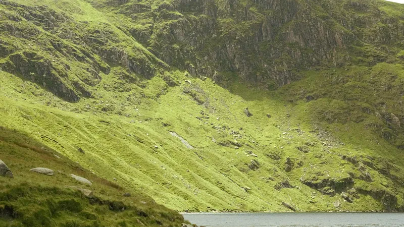 The Lake District
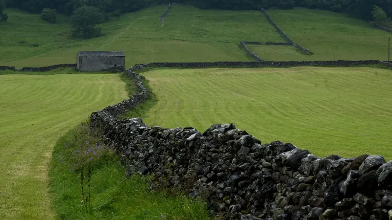 The Yorkshire Dales
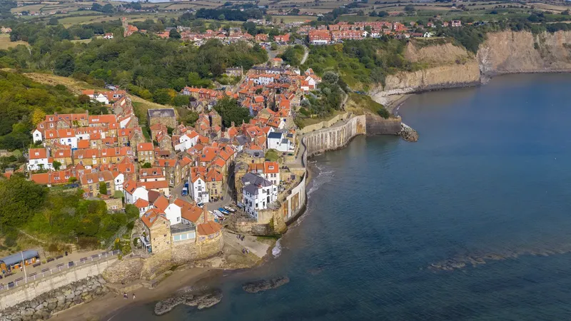 The Coast to Coast Walk
Everything you need on the trail
The free Coast to Coast app turns your phone into a guide that works with no signal.

Offline GPS maps
Download each stage and navigate with full GPS even where there's no signal — across every fell and moor.
Heritage audio guides
Listen to the story of the route — St Bees Priory, Shap Abbey, Nine Standards, Richmond Castle and more — as you reach each site.
Progress tracking
Tick off stages, log your hikes, and watch your sea-to-sea progress build from St Bees to Robin Hood's Bay.
Daily safety check-in
Share your plan with an emergency contact and check in each day — peace of mind on the remote high stages.
Find a walking partner
The buddy finder helps you meet other walkers heading the same way on your dates.
Plan & pack
Build a day-by-day itinerary, get a kit checklist, and see what's at each overnight stop.
Scenes from the trail
A taste of the 190 miles — Lakeland fells, Dales rivers, heather moors and the North Sea coast.


Plan your Coast to Coast
Free guides written from the same stage data as the route pages.
Frequently asked questions
How long does the Coast to Coast Path take to walk?
Most walkers complete the 190-mile (306 km) route in 14 to 16 days, plus a rest day or two. The trail is usually split into 16 day-stages of 8 to 16 miles.
Which direction should I walk it?
Wainwright walked west to east, St Bees to Robin Hood's Bay, so the prevailing wind and sun are behind you. That remains the traditional and most popular direction.
When is the best time to walk the Coast to Coast?
May to September gives the longest days and most settled weather. April and October are quieter but wetter and colder on the high fells.
Is the Coast to Coast a National Trail?
Yes — the Coast to Coast Path was officially designated a National Trail in 2026, having been Britain's most famous unofficial long-distance walk for over 50 years.
Do I need a guide?
No. The route is well-defined and our free app gives you offline maps and GPS for every stage. Many walkers use a baggage-transfer service so they only carry a day pack.
Can you walk just part of the Coast to Coast?
Yes, and many people do. The route divides into four sections — the Lake District, Westmorland and the Yorkshire Dales, the Vale of Mowbray, and the North York Moors — each of which is between two and five days and has both ends on public transport. Each has its own guide here with every stage, its distance, its climb and its grade.
How much climbing is there on the Coast to Coast?
About 8,813 m of ascent across the 16 stages, and it is very unevenly spread: the Lake District alone accounts for roughly 3,879 m of it, while the two Vale of Mowbray stages together climb under 500 m. The hardest single day is Patterdale to Shap at 1,128 m.
Ready to walk sea to sea?
Start with the stage-by-stage guide, then take the app with you on the trail.